 The
day was bright sunshine and in the mid 60's, a solid "10" on anyone's scorecard!
The
day was bright sunshine and in the mid 60's, a solid "10" on anyone's scorecard! Pecan Grove and Plantation Trail
Jean Lafitte National Historical Park and Preserve
Barataria Preserve
Chef Emile's Pecan Grove and Plantation Trail Hiking Log (Loops A & B)
December 5, 2007
The
day was bright sunshine and in the mid 60's, a solid "10" on anyone's scorecard!
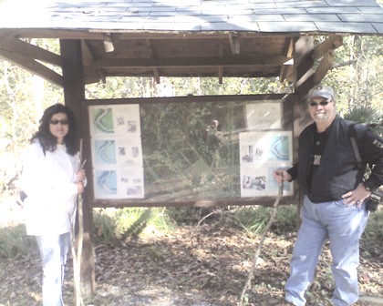
From the Pecan Grove parking lot you walk about 15 yards north and find the trailhead and park map.
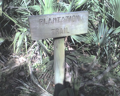
The trail is very well marked, and extremely easy to follow. The sign post at
right, starts the trail. We decided to go counter clock wise but of course
you could choose to circle in the other direction.
 On
my marked up
park map, the trail is labeled Plantation Trail and Loop A, and heads of due
northwest.
On
my marked up
park map, the trail is labeled Plantation Trail and Loop A, and heads of due
northwest.
The above is a Google map of our trail using my Garmin GPSMAP 76CSx recorded trackpoints. I would suggest clicking on the Hybrid map and zooming in. The Garmin calculated that we hiked 3.5 miles.
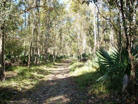
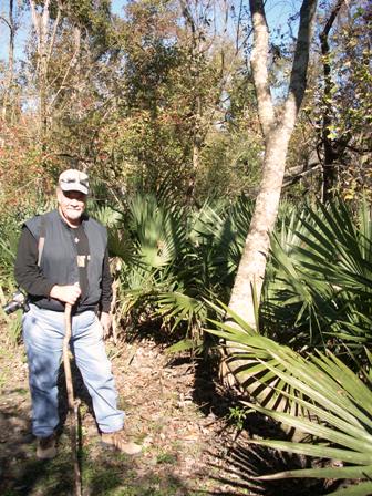
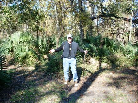
The pic at the right shows how well cleared and straight the trail is! Barataria Preserve never ceases to amaze me!! The entire trail (both loops) are surrounded by palmetto palms. The other trails have palmettos, but not to this extent. Since this is the under brush, at some places you can see a 50 yards or so into the woods. The soft mud of the trail has plenty signs of deer, raccoon and rabbit tracks. There are many animal trails that crisscross the Plantation Trail, soooooo keep your eyes open for critters. I saw a white tail deer on one of my Ring Levee walks.
 After
about 2/3 of a mile the trail takes a 90 degree turn to the Northeast. We saw
this large stand of palmetto along this part of the trail! The palmetto palms
were used by settlers and local Indians as roofing. Laid flat on each other, the
long palms make an excellent roof tile. This part of the trail is only a 1/4 or
less, and leads directly to a crossroads. Loop B circles both Northeast and
Northwest. While the return trail of Loop A leads Southwest.
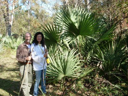
We decided to also hike the Loop B trail and took the Northwest path.
After
about 2/3 of a mile the trail takes a 90 degree turn to the Northeast. We saw
this large stand of palmetto along this part of the trail! The palmetto palms
were used by settlers and local Indians as roofing. Laid flat on each other, the
long palms make an excellent roof tile. This part of the trail is only a 1/4 or
less, and leads directly to a crossroads. Loop B circles both Northeast and
Northwest. While the return trail of Loop A leads Southwest.
We decided to also hike the Loop B trail and took the Northwest path.
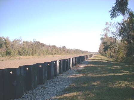 This
trail leads to the hurricane levee that protects the more populated subdivisions
of Jefferson Parish towards the north. There are some woods on the left side of
the pic and a drainage canal that runs along the edge of those woods. As
were were standing there a giant bird flew over about 125 yards away. It had a
white head, light brown under body, full white tail and dark brown wings.
Do you know what that describes??? A BALD EAGLE!!!!
YEP we saw one!! My first ever!!! What a treat!!! He (or she) was flying
from the woods to the left, across the field then into the park. He flew about
where that big tree is on the right, over and passed it. When we finished
the trail, we went to the Visitor's Center and chatted with a ranger, and she
confided that Bald Eagles have been seen in that very area!!! SOOOO, ya gotta
take this trail!!
This
trail leads to the hurricane levee that protects the more populated subdivisions
of Jefferson Parish towards the north. There are some woods on the left side of
the pic and a drainage canal that runs along the edge of those woods. As
were were standing there a giant bird flew over about 125 yards away. It had a
white head, light brown under body, full white tail and dark brown wings.
Do you know what that describes??? A BALD EAGLE!!!!
YEP we saw one!! My first ever!!! What a treat!!! He (or she) was flying
from the woods to the left, across the field then into the park. He flew about
where that big tree is on the right, over and passed it. When we finished
the trail, we went to the Visitor's Center and chatted with a ranger, and she
confided that Bald Eagles have been seen in that very area!!! SOOOO, ya gotta
take this trail!!
If you look at the upper most point of the Google Map, that is where we saw the Bald Eagle.
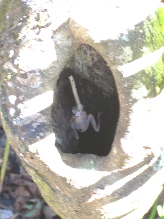
We started our walk back and we were talking about how lucky
we were to see the eagle, when Marc called me over to see a frog in the knot
hole of a tree. At first it looked like the frog had a long tongue and was
sticking it out at us.
 But
when we looked closer, we saw a snake's head over the frog's mouth.
But
when we looked closer, we saw a snake's head over the frog's mouth.
Let me explain what you are seeing in the pic to the left. The snake is only about a 1/4 inch in diameter, and is hanging upside down in the upper hollow of the tree. The frog is a common tree frog, usually green, but can change colors in the winter to a beige or pale brown. It was dead, probably killed by the snake. The snake has captured himself a BIG lunch!! I have no idea as to how that snake is gonna fit that frog inside it's gullet. I know that they can dislocate their jaws in order to swallow something big, but this frog is really large in relationship to the snake!!
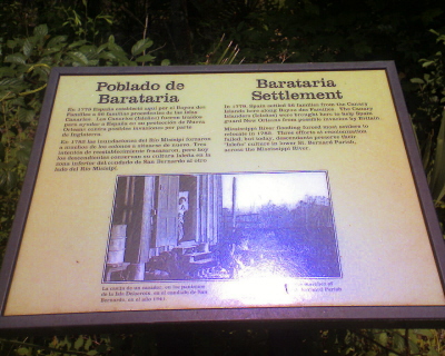 This
This
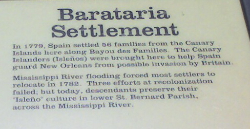 is
the plaque that is at the beginning of the Plantation Trail
(if you go clockwise or the Northeast route) (on one Trailhead Map, this part of
the trail was call Christmas Road) The blow up talks about
the Canary Islanders that were brought here by the
Spanish Governor Galvez in 1779. My GGGG Grandfather, Juan
Raimoundo Garcia settled here. So, it was pretty cool to see that they were
remembered here.
is
the plaque that is at the beginning of the Plantation Trail
(if you go clockwise or the Northeast route) (on one Trailhead Map, this part of
the trail was call Christmas Road) The blow up talks about
the Canary Islanders that were brought here by the
Spanish Governor Galvez in 1779. My GGGG Grandfather, Juan
Raimoundo Garcia settled here. So, it was pretty cool to see that they were
remembered here.
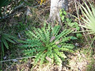 Many
of the early settlers ate from the native plants. This is a thistle plant.
When it matures, it will sprout a large thistle sometimes 3 - 4 tall. the top of
the stalk is eatable and tastes like a cross between an artichoke and celery.
Many
of the early settlers ate from the native plants. This is a thistle plant.
When it matures, it will sprout a large thistle sometimes 3 - 4 tall. the top of
the stalk is eatable and tastes like a cross between an artichoke and celery.
The trail was mostly dry, I wore my mountain hiking boots, because I wanted to
break them in a little more since I hadn't worn
them in almost a year. I am planning a trip to the Hill Country of Texas
for Christmas 2007. (Check back to read my hiking logs in January of 2008!)  It
had not rained for the week so the ground was dry, but there still were patches
of mud (swamps usually are mushy). I say this
because if you are looking to take these trails, you need to get some
Chalmette Wedding Boots or as we call them "Shrimp Boots"!
Basically, they are white wading boots. You can get them from
(Alario Brothers Marine Supplies Inc, 894 Avenue A
Westwego, LA (Louisiana) 70094-4230......Phone: (504) 341-1843),
in Westwego and cost under $25 bucks. Soooooo, I had to clean up the mud
cakes on the soles of my boots after the hike.
It
had not rained for the week so the ground was dry, but there still were patches
of mud (swamps usually are mushy). I say this
because if you are looking to take these trails, you need to get some
Chalmette Wedding Boots or as we call them "Shrimp Boots"!
Basically, they are white wading boots. You can get them from
(Alario Brothers Marine Supplies Inc, 894 Avenue A
Westwego, LA (Louisiana) 70094-4230......Phone: (504) 341-1843),
in Westwego and cost under $25 bucks. Soooooo, I had to clean up the mud
cakes on the soles of my boots after the hike.
 As
usual, I suggest that you take some water with you. It was a beautiful day, but
we needed a drink or two. Also, there were no mosquitoes, but carrying a
little deet, never hurts. BTW, we made Sharon carry all of the stuff!
As
usual, I suggest that you take some water with you. It was a beautiful day, but
we needed a drink or two. Also, there were no mosquitoes, but carrying a
little deet, never hurts. BTW, we made Sharon carry all of the stuff!
For solitude I would rate this trail a 9.9, we only saw one
other person all day!
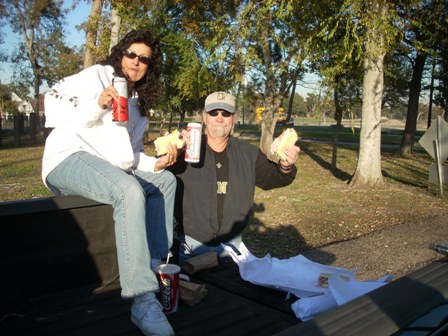
The hikes in the mountains and deserts of Palm Springs and the Hill Country of Texas are great, BUTTTTT to see wild life at every turn is quite special. AND to eat PoBoys and drink some beer at the end of the hike is fabulous!!
Contact us for further details....ChefEmile@CustomCatering.net
![]() to
Home Cookin' Page
or
to
Home Cookin' Page
or ![]() to Hiking Trail Log Page
to Hiking Trail Log Page![]()
Chef Emile L. Stieffel, Aurora Catering, Inc.
email address:
ChefEmile@CustomCatering.net
4016 Red Cypress Dr., Harvey, LA 70058 Phone (504) -329-1344
Copyright © 1995 - 2008 [Aurora Catering, Inc.]. All
rights reserved.
Revised: December 20, 2011.